Mynd:AgrihanNASA.jpg
Jump to navigation
Jump to search

Stødd av hesi forskoðan: 800 × 535 pixels. Aðrar upploysnir: 320 × 214 pixels | 640 × 428 pixels | 1,000 × 669 pixels.
Upprunafíla (1,000 × 669 pixel, stødd fílu: 144 KB, MIME-slag: image/jpeg)
Samandráttur
| Frágreiðing |
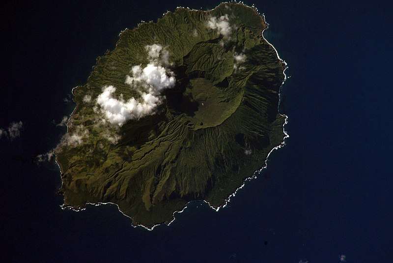
English: NASA Space Shuttle image of Agrihan island in the Northern Mariana Islands.
|
||||||||||||||||||||||||||||||||||||||||||||||||||
| Location | Northern Mariana Islands | ||||||||||||||||||||||||||||||||||||||||||||||||||
| Dagur | |||||||||||||||||||||||||||||||||||||||||||||||||||
| Kelda |
|
||||||||||||||||||||||||||||||||||||||||||||||||||
| Høvundur | NASA | ||||||||||||||||||||||||||||||||||||||||||||||||||
| Object location | | View this and other nearby images on: OpenStreetMap |
|---|
This image or video was catalogued by one of the centers of the United States National Aeronautics and Space Administration (NASA) under Photo ID: ISS006-E-42419. This tag does not indicate the copyright status of the attached work. A normal copyright tag is still required. See Commons:Licensing. Other languages:
|
Lisensur
This file is in the public domain in the United States because it was created by the Image Science & Analysis Laboratory, of the NASA Johnson Space Center. NASA copyright policy states that "NASA material is not protected by copyright unless noted". (NASA media use guidelines or Conditions of Use of Astronaut Photographs).
Photo source: ISS006-E-42419.
|
Søgan hjá fíluni
Trýst á dato/tíð fyri at síggja fíluna, sum hon sá út tá.
| Dagur/Tíð | Lítil mynd | Dimensjónir | Brúkari | Viðmerking | |
|---|---|---|---|---|---|
| streymur | 22. apr 2007 kl. 05:54 | | 1,000 × 669 (144 KB) | Seattle Skier | == Summary == {{Information |Description= NASA Space Shuttle image of Agrihan island in the Northern Mariana Islands. |Source= http://www.oceandots.com/pacific/mariana/agrihan.htm |Date= 01 April 2003 |Location = [[Northern Mariana Islands |
Nýtsla av fílu
Fylgjandi síða slóðar til hesa fílu: